-
This article represents an in-depth discussion about markers used by the AI. We'll dive into what markers there are and how they are most properly applied.
Parts
- About markers: AI markers (this article)
- About markers: pathing markers
Requisites
Map editing tools, such as:
Text editors such as:
- Notepad
The GPG editor is vastly outmatched feature wise on this topic. I recommend using the Ozonex editor for this topic and the article will only discuss how to approach this inside the Ozonex editor.
Personally I use Visual Studio Code as the text editor in this article. The exact same procedure applies for Notepad.
Markers
There are numerous markers available for various usages. The most common markers are the mass extractor, hydrocarbon and the blank markers used for spawn locations or objectives. More uncommon markers are the AI markers such as 'Naval Link', 'Rally Point' or a pathing marker such as 'Amphibous Path Marker'. These are markers that have no meaning to players, instead they have significant meaning to the various AI systems that players use to fight against and learn with.
Throughout this article we will dive into the AI markers. We'll discuss what markers mean to various AI's, how they could be placed in accordance and we'll dive into pathing markers and common misconceptions about them.
This article is written in collaboration with some of the developers of the AI community that surrounds Supreme Commander. In specific:
Markers used for understanding
Rally point
A rally point marker gives the AI an indication where it can send its units after construction when its not ready to be sent out yet. An example situation is when a platoon is being constructed. Until the platoon has been constructed, the units wait at the rally point marker.
This marker is used by:
- Vanilla, Sorian
There are two types of rally point markers:
- Rally Point: For air, land and amphibious units
- Naval Rally Point: For naval units
An AI will use the closest rally point marker to a factory as its rally point. A base can have multiple rally points given that it has multiple factories. Both land, amphibious and air units can rally to a land based rally point. Naval factories will look for the nearest naval rally point.
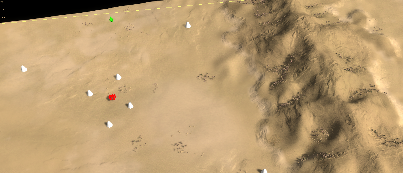
A few rally point markers on the map Withered BattleQuestion: How are Rally Point markers used exactly? The current text (about platoons) is an assumption from observed behavior.
Question: Can a base have multiple functional rally point markers?
Question: Do air units have a rally point marker?
Question: Can Amphibious units use both rally point markers?Expansion area
An expansion area marker provides the AI with an intuition as to where it can expand to. The majority of the AI's will construct a fully-fledged base or a support base at the location, depending whether or not it is a large expansion area. Such an area may include factories, generators, shields and defenses where applicable.
This marker is used by:
- Vanilla, Sorian, LOUD
It does not require mass extractors near it, but mass extractors near an expansion area marker may be preferred over ones that are not. By telling the AI to build a base at the location extractors can be automatically more secured from the perspective of a player.
Besides that it can function as a forward operation base to apply pressure on the enemy. The terrain surrounding an expansion area should be flat and large enough to support a range of buildings, including factories and shields.
Whether or not an expansion is a separately functioning base depends on its distance to the spawn location and other expansions. An expansion should be about 150 - 250 units away from other expansions in order for it to be a standalone base, depending on the AI at hand. Expansions that are close to each other may share their pool of units including engineers, causing odd interactions.
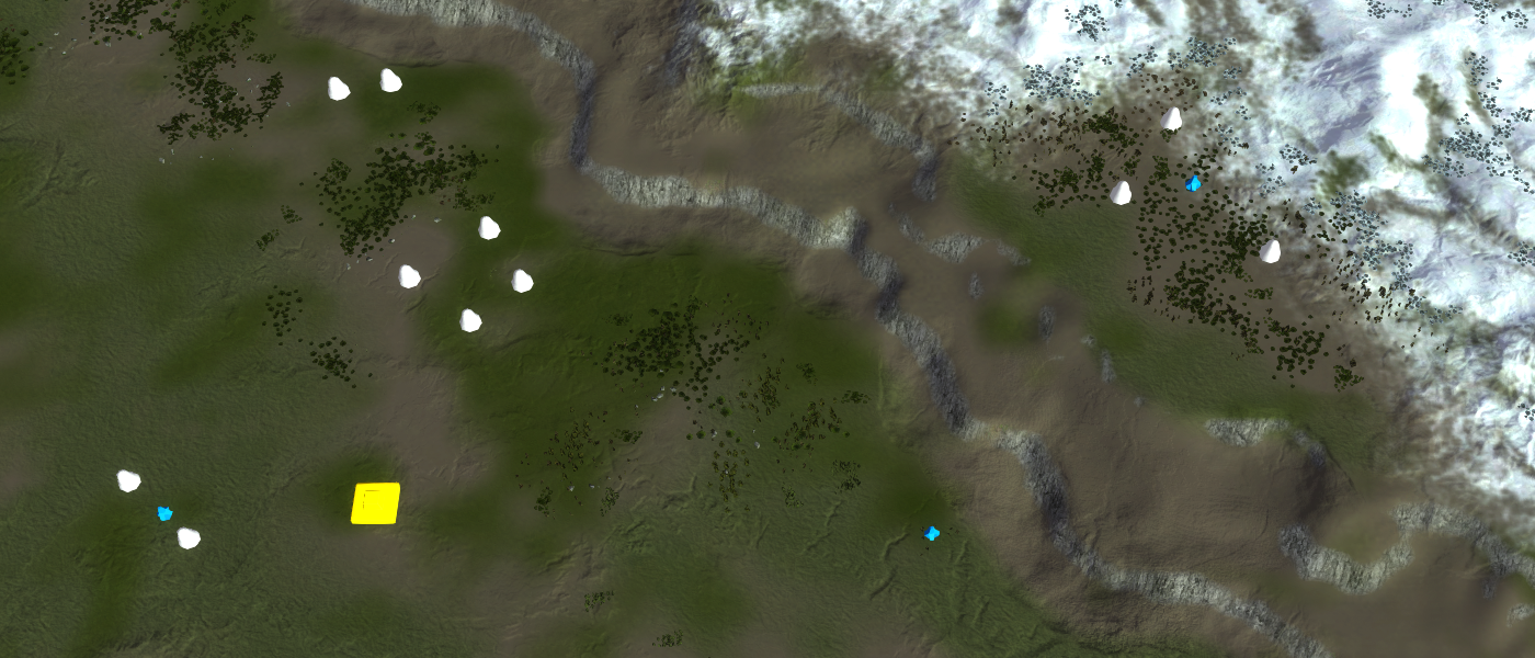
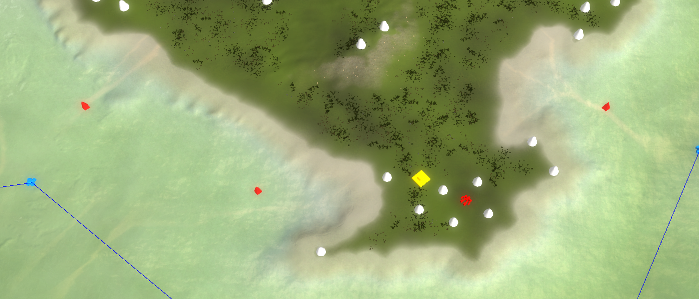
A few expansion markers on the map Open PalmsQuestion: Is there a difference between a large expansion area and an expansion area marker?
Question: Does an expansion area require extractors?
Question: Can expansion area's also construct naval factories if it is close to the water?
Question: Is there a minimal distance between expansions, or between the spawn and an expansion for it to be effective?Naval area
A naval area marker provides the AI with an intuition as to where it can build a full-fledged naval base. This includes naval factories, naval and anti air defenses and a sonar.
This marker is used by:
- Vanilla, Sorian, LOUD
It requires a certain depth such that factories can be safely build and navy units can safely maneuver around the factories. Typically you want the marker to about 50 units off the shore such that a decent naval base can be constructed.
A naval base is much like an expansion but then with a focus on water. Units such as engineers may be shared with other expansions, depending on the direct (Cartesian) distance between the two. If such an interaction would be odd then place t the naval area marker at a sufficient distance from any other expansion area, including the spawn location.
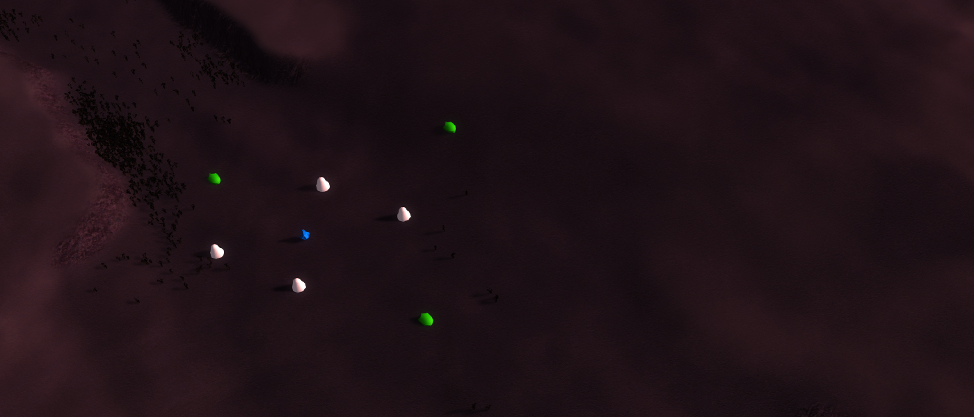
A naval area marker that is far away from the spawning location to prevent odd interactions
A naval area marker that is close to the spawning location units can freely move up and down the beach and therefore interactions make senseQuestion: Does it indeed include a sonar?
Question: Can other structures, such as generators, be constructed on land that is nearby?
Question: I recall that around the spawn location an AI make may naval factories, does this also hold for expansion area's near water?Protected experimental construction
A protected experimental construction marker is quite literally what it says it is: a place where the AI can build an experimental in a relative safe manner.
This marker is used by:
- Vanilla, Sorian
An protected experimental construction marker at the back of the base in Field of IsisNaval Link
A naval link marker is one of the markers that didn't have a meaning until one was given to it. The majority of the AI's will not take this marker into consideration.
This marker is used by:
- LOUD
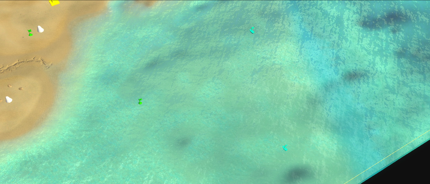
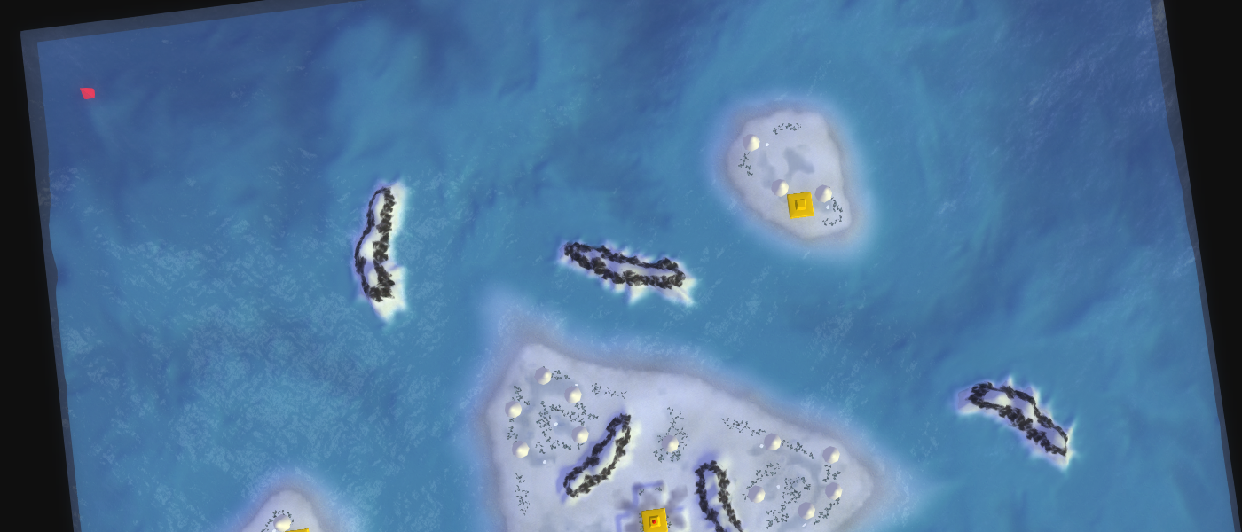
It provides information on where a naval army can do bombardment on some target that is on land. The marker is expected near shores that are applicable for bombardment, significantly closer to the shore than naval pathing markers would be.
A bunch of naval link markers that are significantly more close to the shore than naval pathing markers on Mellow ShallowsDefensive point
The defense point describes where AI's can build support bases that do not have factories. At least defenses will be built and other structures such as air pads and shields depend upon the AI at hand.
This marker is used by:
- Vanilla, Sorian, LOUD
There are two types of defensive point markers:
- Defensive point: A land-based minor gun position, including anti air, tactical missile and point defenses.
- Naval defensive point: A naval-based minor gun position, including anti air, tactical missile and torpedo defenses.
The marker is particularly useful to protect entrances, allow the AI to utilize choke points more effectively or to allow an expansion to be more fortified than it would be on its own.
In the case of LOUD a base constructed at a defensive marker is considered to be a standalone base, given that it has sufficient distance to other expansions.
An expansion fortified with minor gun positions on the Varga PassQuestion: Can these also spawn other structures, such as generators, shields, or even factories?
Question: Is there a minimal distance between a defensive points and the spawn location or expansions for it to be effective?Transport
Transport markers allow for alternative drop off points. There markers are optional. Typically transports use land pathing markers as their drop off points. Transport markers are considered when land pathing markers are either too dangerous.
This marker is used by:
- Sorian, LOUD
Transport markers are especially useful to mark positions that would be strange to include into the pathing graph, such as small islands. They can also be used to allow for more strategic dropping of units, such as behind a mass extractor somewhere.
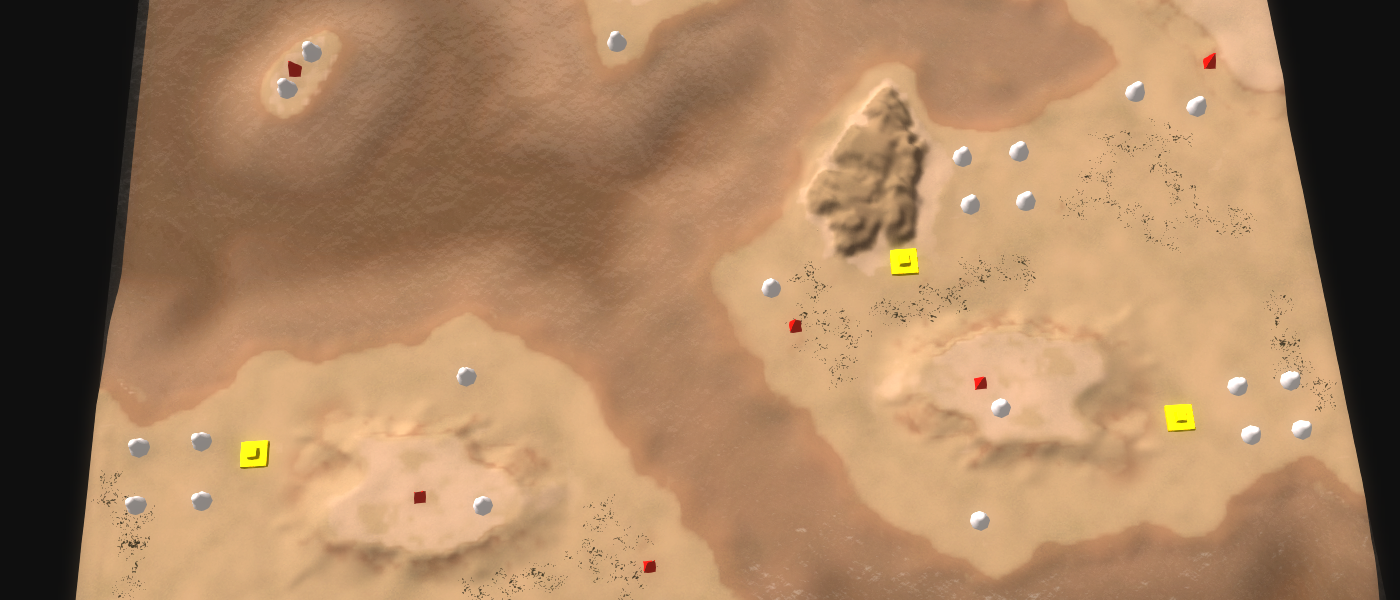
A couple of red transport markers on the map High NoonQuestion: Are these considered before the applicable pathing marker, or after?
Question: Can you place these on water for amphibious drop points?
Question: How about pick-up points, like the ferry function?Island
Island markers are used to mark islands. In practice they are used in the most rudimentary way such that they are more commonly used as a flag to indicate that transports may be important on this map.
This marker is used by:
- Vanilla, Sorian, LOUD
These markers should be placed on each island once.
The island marker being used as a flag on Snoey TriangleQuestion: These are barely used by the AI, correct?Combat zone
Combat zone markers are used to indicate where we as a developer expect confrontations. This marker is poorly named as its main function is to be a target to which the AI can send out scouts. You can think of them as positions that need to be checked on a regular basis.
This marker is used by:
- Vanilla, LOUD
The marker should be placed at the center of paths from one spawn location to another or at remote hiding spots that are not intuitive for the AI but players may use.
A series of combat zones on the map Williamsons BridgeQuestion: Are these also used to send out units?Sources
For more information on how pathing markers are used:
About you
If you have interesting sources, approaches, opinions or ideas that aren't listed yet but may be valuable to the article: feel free to leave a message down below or contact me on Discord. The idea is to create a bunch of resources to share our knowledge surrounding development in Supreme Commander.
If you've used this resource for one of your maps feel free to make a post below: I'd love to know about it!__
-
There is a careful balance between the number of markers used - and the overall performance of the map when being played with AI.
In general terms, less markers is better - BUT - there is a maximum distance that an AI platoon will 'look' when it wants to path from one point to another - and this is different, for air, land and naval.
Air platoons will look for a start or end marker within about 250 ogrids ( about 5k ) of themselves or the goal. Likewise, Naval platoons will look for a start of end marker within about 200 ogrids ( about 4k ). Amphibious and Land platoons have a somewhat shorter seeking range of about 150 ogrids ( about 3k ).
If a platoon cannot find a start or end marker to get from where it is - to where it wants to go - pathfinding will often just fail - and the platoon can sometimes just go inert for the rest of the game.
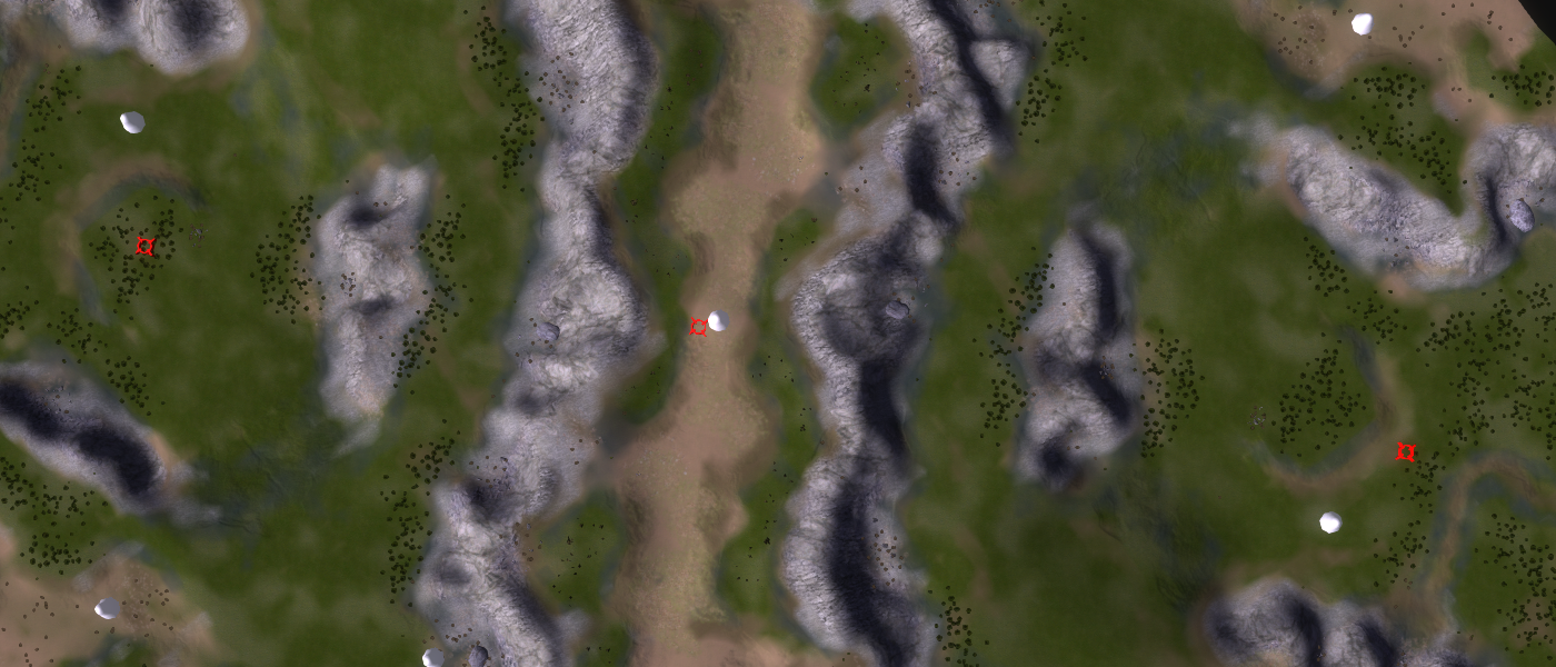
Air markers have the least restriction, and for the best results, a default mapping of Air Markers that allows air platoons to navigate to all the 'Threat Blocks' on the map, is the most efficient. You can see the layout of these 'blocks' by turning on the AI Threat Grid in the tools section of the Ozonex map editor.
Essentially - you'll have a 16 x 16 grid that covers the entire map - which is the same as how the AI monitors threat. This kind of grid will allow an AI that takes advantage of threat measurements to 'thread the needle' and reach intended targets as safely as possible. You can make a default grid like this, for each map size, and simply load it - this saves you a lot of work putting down markers and linking them together.
Likewise, Naval markers are relatively free of restriction - but one - don't get too close to shore. Naval platoons are usually larger in size than most, and since a platoon will try to travel directly to a waypoint - if the point is too close to land, the formation runs the risk of getting 'hung up' - either on the shoreline - or on shallow water. Again, AI markers for movement do not need to be very specific - they only need to be general. The AI platoons will navigate themselves to the nearest marker to start movement, and navigate from the last marker in their path, to their intended goal.
Amphibious markers are REQUIRED. They are used mostly by engineers - and in this respect, they are somewhat unrestricted - but they will also be used by purely amphibious or hover platoons used by the AI. Be careful though - cliffs and tight terrain cause all kinds of path problems - and placing markers too close to cliff edges or river sides can cause issues. Sometimes, a platoon will see such a marker as the one closest to their goal - even though it's not physically capable of reaching it's goal - from a marker like that.
Land movement markers are the most work of all the 4 types. Since the distancing requirements are narrower ( to allow for finer movement paths ) you'll generally need more of them. Again - movement markers are general - and don't need to be too specific - except for tight terrain.
While platoons will 'form fit' themselves to pass thru tight terrain, the problems caused by this type of terrain are not solved by putting more markers on a map. In fact, especially for land platoons, too many markers of a short distance cause increasing movement delays - because - unlike human platoons - an AI platoon, that's in formation, will want to re-form at every movement marker. This is a shortcoming of the AI functions imbedded in the game - so often AI designers will forgo formation movement in favor of either really small platoons, or larger ones that just 'swarm' from point A to point B.
As cautioned before - be very careful about how close you put markers to terrain obstacles - the further away - the better. This tends to not only save a lot of extra processing by the AI, in pathfinding, but it will minimize the issues I mentioned previously about platoons thinking that crowding around the top of a cliff is the best way to get to movement marker that's too close to them, down in the valley.
-
Hi Sprouto, I was hoping you or Uveso would provide some input. I'll work through your input and add it to the article where applicable
") . It is also nice to see that some of my own assumptions (don't place them too close to unwalkable terrain) are actually very valid.
. It is also nice to see that some of my own assumptions (don't place them too close to unwalkable terrain) are actually very valid.And a personal question: does this mean that the generated grid of the Uveso mod is in fact way too dense and generally too close to cliffs (in case of land) or beaches / rocks (in case of navy)? And should it therefore be included in this article? Because people may or may not look at this article how things are done and this may cause an avalanche of maps that are slow for the AI.
-
It may, in some cases be too dense, but it works well for the size of maps usually involved with FAF - and it overcomes a lot of issues where maps are either poorly marked, or not marked at all - which is a big plus. On larger maps, this many nodes will cause some visible impact in game speed - especially as you get more AI involved.
-
 J Jip referenced this topic on
-
J Jip referenced this topic on
-
J Jip referenced this topic on
-
J Jip referenced this topic on
-
J Jip referenced this topic on
-
J Jip referenced this topic on
-
J Jip referenced this topic on
-
J Jip referenced this topic on
-
J Jip referenced this topic on
Hello! It looks like you're interested in this conversation, but you don't have an account yet.
Getting fed up of having to scroll through the same posts each visit? When you register for an account, you'll always come back to exactly where you were before, and choose to be notified of new replies (either via email, or push notification). You'll also be able to save bookmarks and upvote posts to show your appreciation to other community members.
With your input, this post could be even better 💗
Register Login